Nautical Maps and Exploration
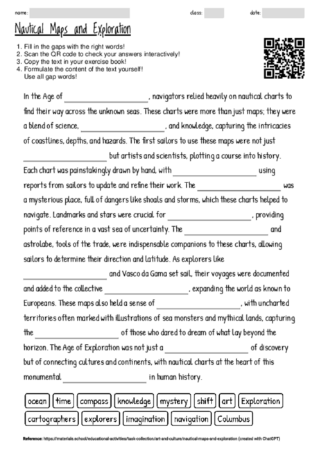
Cloze texts, like the one about the role of nautical charts in the Age of Exploration, serve as an effective educational tool by engaging students in active reading and comprehension. They encourage learners to focus on context clues to fill in the blanks, thus enhancing their ability to infer meaning and understand the importance of key concepts. This particular text combines elements of history, geography, and science, providing a multidisciplinary approach to learning. By highlighting terms such as "exploration," "art," "cartographers," and "navigation," students are prompted to consider the multifaceted nature of historical exploration and its reliance on scientific and artistic methods. The act of deciphering which term fits each blank not only reinforces vocabulary but also deepens understanding of the historical period and the technological advancements that made exploration possible. This cloze text can be used in various phases of learning, from introducing the topic to reinforcing knowledge through active recall. It serves as a springboard for discussions on the impact of exploration on global connections and cultural exchanges, offering a holistic view of history that goes beyond mere dates and events. Furthermore, the task of filling in the blanks can adapt to different learning styles, supporting visual learners through the mental mapping of historical narratives and kinesthetic learners through the physical act of writing or typing out the answers. In conclusion, this cloze text provides an engaging and informative way to explore the Age of Exploration, its technologies, and its lasting impact on the world.
There are currently 3743 cloze worksheets on a wide range of topics available on materials.school.
You can freely download the latest worksheet from this website to help you familiarize yourself with the functionality and potential of the worksheets.